National Landslide Susceptibility Mapping Programme
National Landslide Susceptibility Mapping Programme
Under the National Landslide Susceptibility Mapping (NLSM) Programme, launched in the year 2014-15, the Geological Survey of India (GSI), Ministry of Mines takes up landslide susceptibility mapping of landslide prone areas in the country.
What is a landslide?
- Landslide is a physical phenomenon when a part of rock, and/or debris/ soil fall due to the action of gravity.
- It is caused by a set of terrain-specific geofactors (e.g., slope, lithology, rock structure, land use/ cover, geomorphology etc.) and in general is triggered by heavy rainfall or earthquake tremors.
- In Indian terrain, landslide events are mostly triggered by monsoonal rainfall but examples of earthquake-triggered landslide is also not uncommon in India (e.g., Uttarkashi Earthquake, Chamoli Earthquake, Sikkim Earthquake etc)
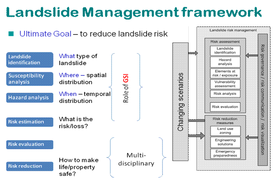
Landslide Hazard
Protection of life and properties from landslide disaster is indispensable in creating a safe environment for the society. The national imperative towards safety due to landslide initiation is increasing in view of the higher rate of human settlement in the mountain slope across the country.
Landslides are significant amongst those hazards that can be disastrous to human life and property. It is estimated that economic loss due to landslides may reach between 1-2% of the gross national product in many developing countries. Evaluating and mitigating the landslide hazard and risk is a major challenge for the technocrats and decision makers in the developing world as 80% of the reported fatalities due to landslide is within the developing countries.
In India, about 0.42 million sq. km or 12.6% of land area, excluding snow covered area, is prone to landslide hazard. Out of this, 0.18 million sq. km falls in North East Himalaya, including Darjeeling and Sikkim Himalaya; 0.14 million sq. km falls in North West Himalaya (Uttarakhand, Himachal Pradesh and Jammu & Kashmir); 0.09 million sq. km in Western Ghats and Konkan hills (Tamil Nadu, Kerala, Karnataka, Goa and Maharashtra) and 0.01 million sq. km in Eastern Ghats of Aruku area in Andhra Pradesh. The landslide-prone Himalayan terrain falls in the maximum earthquake-prone zones (Zone-IV and V; BIS 2002) where earthquakes of Modified Mercalli intensity VIII to IX can occur, and thus, are also prone to earthquake-triggered landslides. The most recent example is the aftermath of 18 September 2011 Sikkim Earthquake in the Sikkim-Darjeeling Himalayas.
Vision and Strategy (2020-2030) on landslide hazard management
During August 2020, the Ministry of Mines (MoM) has approved the following vision and strategy plans for GSI to carry out landslide hazard studies in India for the next 10 years (2020-2030).
For more information click here.
Activities taken up
Under the National Landslide Susceptibility Mapping (NLSM) Programme, the Geological Survey of India (GSI), Ministry of Mines has completed landslide susceptibility mapping of 4.3 lakh sq. km. of landslide prone areas in the country, including approximately 42,093 sq. km. in Himachal Pradesh. For providing suitable remedial measure for landslides, unstable slopes, etc., detailed site-specific landslide investigations are taken up regularly by GSI based on requests from stakeholders concerned.
Source : GSI
Last Modified : 12/19/2023
Provides information about Landslide Atlas of Indi...
Provides information about Climate Hazard & Vulner...
This topic covers the Information related to Lands...